MobilityDB

An open source geospatial trajectory data management & analysis platform.

View on Github

Location tracking devices, such as GPS, are nowadays widely used in smartphones, and in vehicles. As a result, geospatial trajectory data are currently being collected and used in many application domains. MobilityDB provides the necessary database support for storing and querying such geospatial trajectory data

MobilityDB is implemented as an extension to PostgreSQL and PostGIS. It implements persistent database types, and query operations for managing geospatial trajectories and their time-varying properties.

Learn More

Benefits

Compact geospatial data storage
Rich mobility analytics
Easy to use full SQL interface
Python adapters
Moving Features standards (OGC)
PostgreSQL ecosystem

Docker containers with MobilityDB and all its dependencies are available

Easy to Use

MobilityDB provides two main geospatial trajectory type: tgeompoint for a temporal geometry point, and tgeogpoint for a temporal geography point. Both can represent a geospatial point that moves over time, where the coordinates are respectively expressed as PostGIS geometry or geography. It also provides a rich set of functions to manage these type; including: input/output, topological relationships, speed, direction, distance, etc.
arrow

Users' Applications

Mosgortrans Mobility Department

Nina Belyavskaya works at Mosgortrans Mobility Department, whose mission to optimize road public transport routes and timetables in Moscow, Russia. She reported her experience of migrating from PostGIS to MobilityDB in PGConf.Russia 2020

Have a look at the conference.
pgc

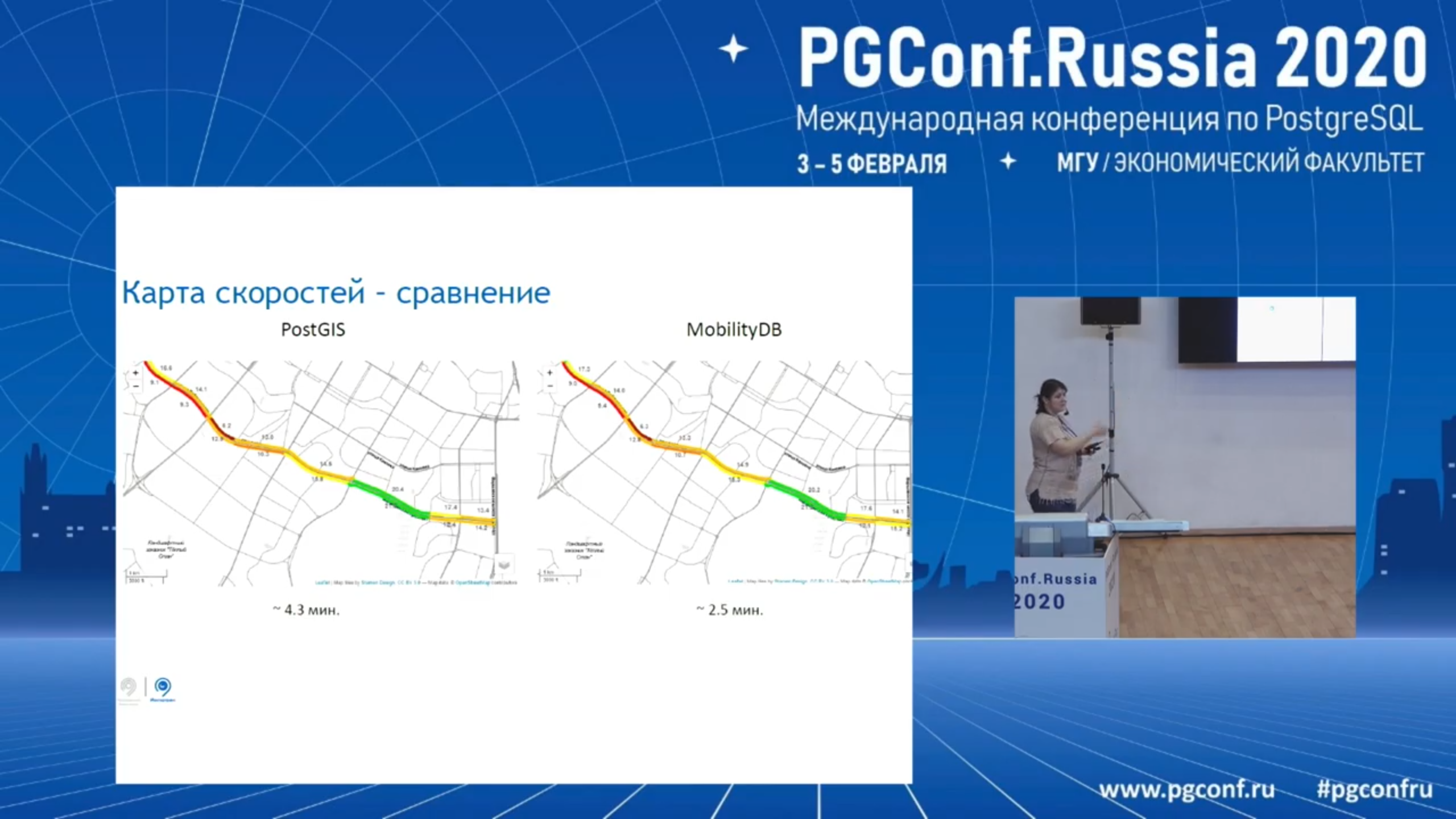
Digital taxi-top advertising

Bommakanti Krishna Chaitanya works at Adonmo, a company specialized in digital taxi-top advertising.

He reported his experience on using MobilityDB together with SQLAlchemy here
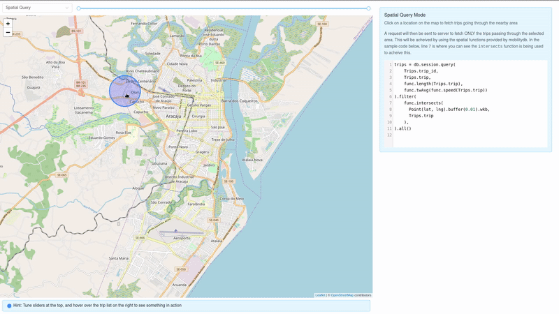
taxi

Covid pandemic

Florian Nadler works at Cybertec, a company specialized on Data Science using PostgreSQL. He reported his experience on using MobilityDB for intersecting tracks of persons in the context of the Covid pandemic here

He reported his experience on using MobilityDB for intersecting tracks of persons in the context of the Covid pandemic here
covid

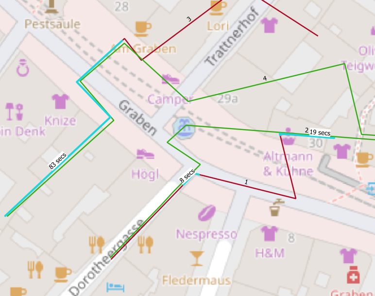
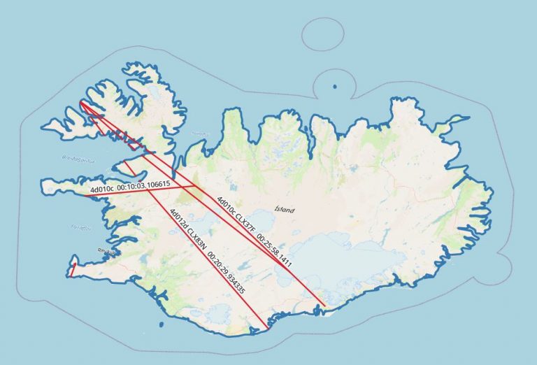
Analyzing historical flight data with MobilityDB

Second article from Florian Nadler about MobilityDB. He invests some time and showcase MobilityDB’s rich feature stack by analyzing historical flight data from OpenSky-Network, a non-profit organisation which has been collecting air traffic surveillance data since 2013.

This article covers all the steps needed to quick-start analyzing spatio-temporal data with PostGIS and MobilityDB together.
map of flying_data